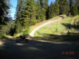
The Middle Fork ATV trail winds through the forest
Middle Fork ATV Trails
![]()
![]()
Description: The Middle Fork ATV Trails consist of 10 miles of former logging roads which wind through the forest. A portion of the trail system is looped. Many users camp in the Calispell Creek drainage which provides numerous unimproved dispersed camp sites. County Road #2022 which accesses the drainage as well as some Forest Service roads is open to all motorized vehicles providing many riding opportunities for motorized enthusiasts.The terrain varies from forested to open meadows. Trails follow old logging roads. Off Highway Vehicles, (OHV) are allowed on many other roads in the Colville National Forest. Please consult the latest Motor Vehicle Use Map for more information.


![]()
![]()